
In 2026, a rehabilitation of Bunts Road (CR-232) is planned to begin, stretching from Lakewood Heights Boulevard to Clifton Boulevard (US-6). This project will be funded by NOACA (Surface Transportation Block Grant Program (STBG) funds), the Ohio Department of Transportation (ODOT) and the City of Lakewood.
Project Description
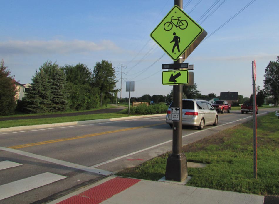
The City of Lakewood is working to make travel easier and safer on Bunts Road for vehicles, pedestrians, and bicyclists. Improvements would address the deteriorated pavement/curbs/sidewalks, long pedestrian crossing distances, Clean Water Lakewood, and Consent Decree sewer improvement requirements, aging watermain infrastructure, surface drainage, streetlighting, bicycle lanes, aging signage, and other appurtenances.
It is planned to construct the project in two (2) one-year phases by maintaining one southbound traffic lane and detouring northbound traffic to Warren Road. In 2026, Phase One would entail work from Lakewood Heights to Franklin. In 2027, Phase Two would entail work from Franklin to Clifton.
Active Transportation Plan Elements
The Bunts Rehabilitation Plan was designed in accordance with Lakewood’s Active Transportation Plan (ATP), which was adopted by City Council in 2024 following an extensive collaboration between City departments, Council members, local organizations, and public input. During the public comment process, residents identified Bunts as one of the streets or road with a high number of challenges related to walking and biking.
In the ATP, Bunts Road was identified as part of the high-risk network of roadways within the city. Some of the recommended features from the ATP that are being considered or included in the Bunts Rehab Plan include:
- The shared use path along the Bunts corridor;
- Leading Pedestrian Interval (LPI) crosswalks to allow pedestrians to establish a presence in the crosswalk;
- Curb extensions at crosswalks to shorten pedestrian crossing distances.
Project Changes and Updates
Following the Public Comment period, several updates were made to the project plans. You can find the changes that were made in the expandable section to the right, or by clicking here.
Project Drawings, Renderings, and Presentation
 |  | |
| Rendering of Bunts Road Proposed Design | Bunts Road Redesign Plot (Zoom in and scroll PDF to view details) | |
 | ||
| May 7, 2024 Public Presentation |
A public meeting to discuss the project was held on May 7, 2024 at 6:00 PM at Lakewood High School. During this meeting, the proposed improvements were shared with the community. There was also an opportunity for the community to ask questions about the project as we gather community input before making decisions.
The meeting included a presentation followed by a question-and-answer session and open house with the ability for the public to provide comments.
Project Area

-
Bunts Road Plan Changes and Updates+-
The following roadway design changes made after the Public Meeting/Comments period:
Parking Lanes
The parallel parking lane was changed to the east (northbound Bunts Road) side of the pavement between Lakewood Heights Boulevard and Madison Avenue, and from Franklin Boulevard to Clifton Boulevard. This places the parking lane on the opposite side of the Shared Use Path within those limits.
Between Madison Avenue and Franklin Boulevard (adjacent to Lakewood High School), the parking lane will remain on the west (southbound Bunts Road) side of the pavement. Since there are limited driveways on the west side in the block, this will provide the maximum amount of parallel parking spaces. In the area adjacent to the driveways to the High School, the parking will be prohibited as necessary to provide the required sight distance to bicycles and pedestrians on the Shared Use Path from drivers during into these drives.
Leading Pedestrian Intervals
Several comments were received to consider including Leading Pedestrian Intervals (LPI) in the signal timing for pedestrians and bicycles on Bunts Road. The LPI gives pedestrians the opportunity to enter the crosswalk at an intersection 3 to 7 seconds before vehicles are given the green light. This helps the pedestrians better establish their presence in the crosswalk before vehicles can proceed. During project design, the timing at all signalized intersections on Bunts Road (with the exception of Lakewood Heights Boulevard) will be reviewed to determine if an LPI can be included without affecting the overall operations of the intersection.
Left Turn Lanes
Left turn lanes in both north and south bound directions will be added to Bunts Road at Franklin Boulevard.
Sidewalk and Crossing Improvements Near Giant Eagle Parking Lot
Communication has been started with representatives of Giant Eagle to address the driveways off Bunts Road. Improvements to these driveways will be made after these discussions.
Comments were received regarding the numerous pedestrians crossing Bunts south of the railroad tracks to access Giant Eagle and the safety concerns. After further evaluation, a mid-block crossing with push button activated Rectangular Rapid Flashing Beacons (RRFB) has been added to the plans south of the railroad tracks (in addition to the planned RRFB crossing at Merl Avenue). Below is a photo of a typical push button-activated RRFB.
Permeable Pavers
The pavement for the parking lanes has been changed to permeable pavers. This change allows for: 1) a distinction between the traveling lane and parking lane; and, 2) a reduction in storm water runoff.
A new separate storm sewer system will collect all the impervious surface runoff from the entire project site. The existing storm mains will only service the private properties. This improvement greatly reduces the potential for private property flooding.
Curb Bump-Outs
Detroit Ave. curb bump-outs have been added at the northwest and southeast corners of Detroit and Bunts to reduce the crosswalk lengths.
-
Bunts Road Frequently Asked Questions+-
We have assembled answers to the most commonly-asked questions and comments on the project during the public meeting and public comment period.
Q: What is the process for plan development?
A: Please see the Project Plan Update and Schedule section on the Bunts Road Rehab page.
Q: Do not narrow (or widen) the Bunts Road pavement width.
A: Except for the approaches at the intersections, the existing width of Bunts Road (between curb faces) is 28 feet between Lakewood Heights Boulevard and Detroit Avenue, and between 34 to 36 feet between Detroit Avenue and Clifton Boulevard.
The proposed width between curb faces for the length of the project will be 28 feet, allowing for an 11-foot-wide travel lane, a 10-foot-wide travel lane adjacent to the parking lane, and a 7-foot-wide parking lane.
Therefore, the pavement width between Lakewood Heights Boulevard and Detroit Avenue will remain the same, and the width between Detroit Avenue and Clifton Boulevard will decrease but will be consistent with the rest of Bunts Road. It will also meet the required travel and parking lane widths from ODOT Design Manuals.
Q: Do not decrease the amount of green space (tree lawn) on Bunts Road.
A: Between Lakewood Heights Boulevard and Detroit Avenue, the width of green space will decrease by 5 feet (from approximately 21 feet wide to 16 feet wide) due to the installation of the shared use path. Drainage structures along Bunts Road will be added as necessary to capture the additional stormwater discharge. In addition, permeable pavers will be placed within most of the parking lane to produce a porous surface and reduce the amount of stormwater runoff.
Between Detroit Avenue and Clifton Boulevard, the width of green space will slightly increase due to the narrowing of the existing pavement width by 6 to 8 feet.
Q: How will vehicular traffic be maintained during construction?
A: During construction on a given section of Bunts Road, one-way southbound traffic will be maintained with an 11-foot-wide travel lane. There will also be pavement adjacent to the travel lane available for the Contractor to use, and can also be used for delivery trucks, resident parking during driveway closures, and non-Contractor work hours, etc. Northbound traffic will be detoured to Warren Road.
Q: Will a left turn lane for northbound traffic at Franklin be included?
A: Left turn lanes in both northbound and southbound directions will be added to Bunts Road at Franklin Boulevard.
Q: Why not create the bike path on a north-south street with less traffic?
A: Bunts Road was identified by the Lakewood Active Transportation Plan as a corridor with the highest potential risk for bicycle and pedestrian crashes. Installation of the bike path along Bunts Road provides bicyclists and pedestrians a safe and comfortable infrastructure to provide year-round access to Lakewood High School, parks, local amenities, resources, and the regional network.
Q: All crosswalks at all intersections should incorporate curb extensions.
A: Bump-outs to reduce pedestrian crossing widths are being considered at all intersections.
Q: The project will remove my tree lawn, which is part of my property. How will I be compensated?
A: At no location will the entire tree lawn be removed from the roadway. The tree lawns on Bunts Road are located within the public right-of-way that is owned by the City.
Q: Why use audible signals? They do not belong in a residential area.
A: The recently published PROWAG (Pedestrian Right-of-Way Accessibility Guidelines) was developed by the US Access Board to create accessible routes along public streets. These Guidelines (R1307.4-5) state that “All new and altered pedestrian signal heads installed at crosswalks must include “accessible pedestrian signals” (APS), which have audible and vibrotactile features indicating the walk interval so that a pedestrian who is blind or has low vision will know when to cross the street.” The project is geared to meet the Active Transportation Plan Vision Statement:
“Lakewood envisions a complete and connected network for people walking and biking that provides year-round access to local amenities, resources, and the regional bicycle and pedestrian network. Lakewood envisions a culture of respect for all roadway users, and bicycle and pedestrian infrastructure that is safe and comfortable for people of all ages and people with disabilities.”
Q: Will the design include improvements to address the sidewalk in front of Giant Eagle?
A: Communication has been started with representatives of Giant Eagle to address the driveways off Bunts Road. Improvements to these driveways will be made after these discussions. See Items 4 and 5 in the Plan Changes section.
Q: If the sidewalk on the west side of Bunts is replaced by a bike path, where will students that attend the High School walk?
A: The path being installed on the west side of Bunts Road is intended to be a multi-use path designed for use by both pedestrians and cyclists for transportation and recreational purposes.
Q: How will driveway access be maintained during construction? How will the residents be notified and what accommodations will be made to provide parking?
A: Full access will be provided to the Bunts Road property owners during the construction of the project, with the exception of short-term closures to allow for the removal and installation of the curb/driveway and sewer/water work. Residents will be notified by the Contractor in person and/or door hangers in advance of all closures. During the time that the driveway is closed, residents will be provided with on-street parking and/or parking on side streets. The city will maintain the Bunts project website and provide bi-weekly updates as construction advances for residents that sign up for email notifications.
Q: Will the crosswalks be restored to the brick material like others around the City?
A: The crosswalks noted around the City are usually colored concrete with a stamped brick pattern. The City has observed that the stamped pattern causes issues with disabled persons using walkers and wheelchairs. Therefore, this project will include the colored concrete within the crosswalk but will eliminate any stamped pattern.
Q: Will water, gas, etc. be turned off for any extended periods of time?
A: During the time when residents’ water service lines are being replaced, water service will be temporarily disrupted for a short period of time to allow the connection to the new watermain. Residents will be notified in advance as to when this disruption will occur.
Work performed by the gas company will be done by the utility owner and all coordination will be done through their Contractor.
Q: Will we still be able to receive deliveries and mail as usual?
A: The city will coordinate with the Contractor and individual delivery services to keep any disruption of services to a minimum; however, there may be certain times during construction that a disruption is unavoidable. In these cases, the residents will be notified in advance.
Q: How will lighting be addressed?
A: The project will include the installation of new decorative streetlights along the length of the street. During project design, lighting engineers will review the locations and spacing of the new streetlights to make sure that lighting is as evenly distributed as possible while maintaining necessary lighting levels.
Q: How will access for emergency vehicles be addressed during construction?
A: Close coordination between the City, Contractor, and Emergency services will be maintained at all times during construction. Emergency vehicles will be able to access all properties along Bunts Road at all times, with police closing road access for vehicles as necessary to provide priority to emergency vehicles.
Q: Is there a way to save more trees?
A: During design, each tree will be evaluated to determine if it can be saved with the current design; however, it should be noted that due to ODOT Design Criteria, all tree edges that are within 1 foot from the edge of the path, or within 1 ½ feet of the face of the new roadway curb, must be removed. In addition, the location of the property’s water and/or sewer lines that are being replaced may be located adjacent to or under an existing tree, in which case that tree will need to be removed. The city intends to replace trees and plant additional trees to increase tree canopy along the corridor.
Q: Can the bike path be made of another material such as concrete or porous asphalt?
A: Asphalt is generally used for bike paths. Concrete material and installation costs are generally twice the cost of asphalt; concrete cannot be repaired, so large cracks must be completely replaced. Concrete paths would also require jointing along the path which may affect rideability, especially as the path ages and joints begin to fail.
Installing porous asphalt would require a costly thick stone bed under the path to store and release the water that drains through the asphalt. A porous asphalt path would also require substantial maintenance to sustain the pavement so that the pores in the pavement remain clear and able to pass the water.
Q: Can the path be less than 10 feet wide?
A: The ODOT Multimodal Guide suggests a minimum path width of 11 feet; the Guide states that widths less than 11 feet “do not provide space for people to travel side-by-side and be passed by other users approaching from the opposite direction without increasing the potential for conflicts.” Although the path being proposed is less than the 11-foot suggested width, this is the width used on most Metroparks paths, and is the same width as the path that was installed on Detroit Road at Sloane Avenue in Lakewood.
Q: Will refuse collection and leaf collection services be disrupted by construction?
A: No. Refuse collection will continue as normal with the exception that collection will be generally at 6 AM. Leaf collection will be coordinated with the Contractor and will still take place during construction.
-
Project Plans and Schedule+-
Project Plans and Schedule
Stage 1 Plans were submitted to ODOT for review and comment. Stage 1 plans generally detail the line, grade and typical cross sections of the proposed improvements. ODOT comments have been received and are being addressed.
Stage 2 Plans are being prepared for an April 2025 submittal. These plans generally include:
- Survey details
- Plan and profile sheets with existing topography
- Construction limits
- Grading
- Intersection details
- Water and sewer work
- Pavement and signing plan
- Signal plans
- Maintenance of traffic plan with sequence and phasing
- Utility correspondence
- Right-of-way plan sheets
- Environmental documents
- Geotechnical report and profiles
- Updated cost estimate and updated construction schedule.
Stage 3 Drawings are due in August 2025 which are the +/-90% complete plan set with specifications and estimate. Final Plans, Specifications, and Estimate are due October 2025, and Construction Advertisement, Bid, and Award will take place from December 2025 to March 2026.
Estimated Construction Schedule
Phase 1 (Lakewood Hts Blvd to Franklin Blvd) – April 2026 to April 2027
Phase 2 (Franklin Blvd to Clifton Blvd) – May 2027 to November 2028
-
Project Communications+-
-
Public Engagement Timeline+-
The Bunts Road Rehabilitation Project has sought public input throughout every stage of the process. A timeline of public engagement is detailed below.
April 25, 2024: Resident Notice Letters Sent; Yard Signs Placed
On April 25, letters were sent out to residents of Bunts Road to notify them of the project. This letter provided residents the date of the Public Meeting that was held on May 7; the website link where the project plans and presentation were posted; and instructions on how to submit public comments.
Around this time, yard signs were placed in public areas along Bunts Rd. and at Lakewood City Hall notifying residents of the public meeting as well.
May 7, 2024: Public Meeting and Start of Public Comment Period
A public meeting was held in the Lakewood High School Cafeteria on May 7, 2024. At this meeting, the City Engineer, Planning Department, Public Works, and Osborn Engineering presented the project plans and renderings. The team answered questions from members of the public that were in attendance.
This meeting also marked the beginning of the Public Comment Period. Meeting attendees were provided with comment cards that they could turn in at the end of the meeting, and a form was made available on the City of Lakewood website for residents to provide feedback digitally.
June 6, 2024: Planning Commission Meeting
The Bunts Road Rehabilitation Project was presented to the Planning Commission on June 6, 2024. This meeting was open to the public, and several interested parties offered their public comments. The agenda, plans, and meeting minutes can be found below.
Meeting Agenda and Plans Presented
June 9, 2024: End of Public Comment Period
January 15, 2025: Plans Updated on Webpage
The public comment period ended on June 9, 2024. The project team reviewed all public comments and made changes to the project plan that are detailed here.